Map of Guadeloupe, 1759. Antilles Archipelago, Caribbean Sea. France took possession of the island on 28 June 1635, after landing at Pointe Allegre. During the Seven Years War, was conquered by England, founding the Port of Pointe-a-Pitre. Taking of the island of Guadeloupe by the British troops on April 13, 1759. Engraving published in 1765 by the cartographer Jean de Beaurain (1696-1771) as an illustration of his Great Map of Germany, with the events that took place during the Seven Years War. French edition, 1765. Military Historical Library of Barcelona (Biblioteca Histórico Militar de Barcelona). Catalonia. Spain. Author: Jean de Beaurain (1696-1771). French geographer.
This asset has restrictions and cannot be purchased online. Get in touch for more details.
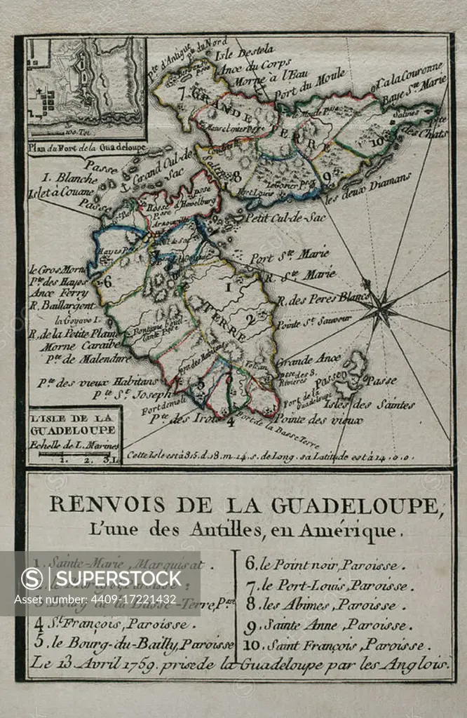
SuperStock offers millions of photos, videos, and stock assets to creatives around the world. This image of Map of Guadeloupe, 1759. Antilles Archipelago, Caribbean Sea. France took possession of the island on 28 June 1635, after landing at Pointe Allegre. During the Seven Years War, was conquered by England, founding the Port of Pointe-a-Pitre. Taking of the island of Guadeloupe by the British troops on April 13, 1759. Engraving published in 1765 by the cartographer Jean de Beaurain (1696-1771) as an illustration of his Great Map of Germany, with the events that took place during the Seven Years War. French edition, 1765. Military Historical Library of Barcelona (Biblioteca Histórico Militar de Barcelona). Catalonia. Spain. Author: Jean de Beaurain (1696-1771). French geographer. by Album/Prisma/Album Archivo is available for licensing today.
Looking for a license?
Click here, and we'll help you find it! Questions? Just ask!
Click here, and we'll help you find it! Questions? Just ask!
DETAILS
Image Number: 4409-17221432Rights ManagedCredit Line:Album/Prisma/Album Archivo/SuperStockCollection:Album Archivo Contributor:Album / Prisma Model Release:NoProperty Release:NoResolution:3248×4990