Map of Louisiana (Mississippi), Johann Baptista Homann, 1664 - 1724, Etching and engraving, hand-colored, on white laid paper, Map of Louisiana shows the Eastern part of the United States up to Canada; different colors are used for Louisiana (green), Eastern States (yellow), New Mexico (pink) and Canada (pink). On upper left corner, title of map embellished with an allegorical figure; below view of Niagara Falls. In lower right corner, a vignette with the coat-of-arms of Lns. Gall Societatis Indiae Occidentalis and below and Indian man and woman with a bull. (OPB '59), Germany, after 1718, ephemera, Print, Print
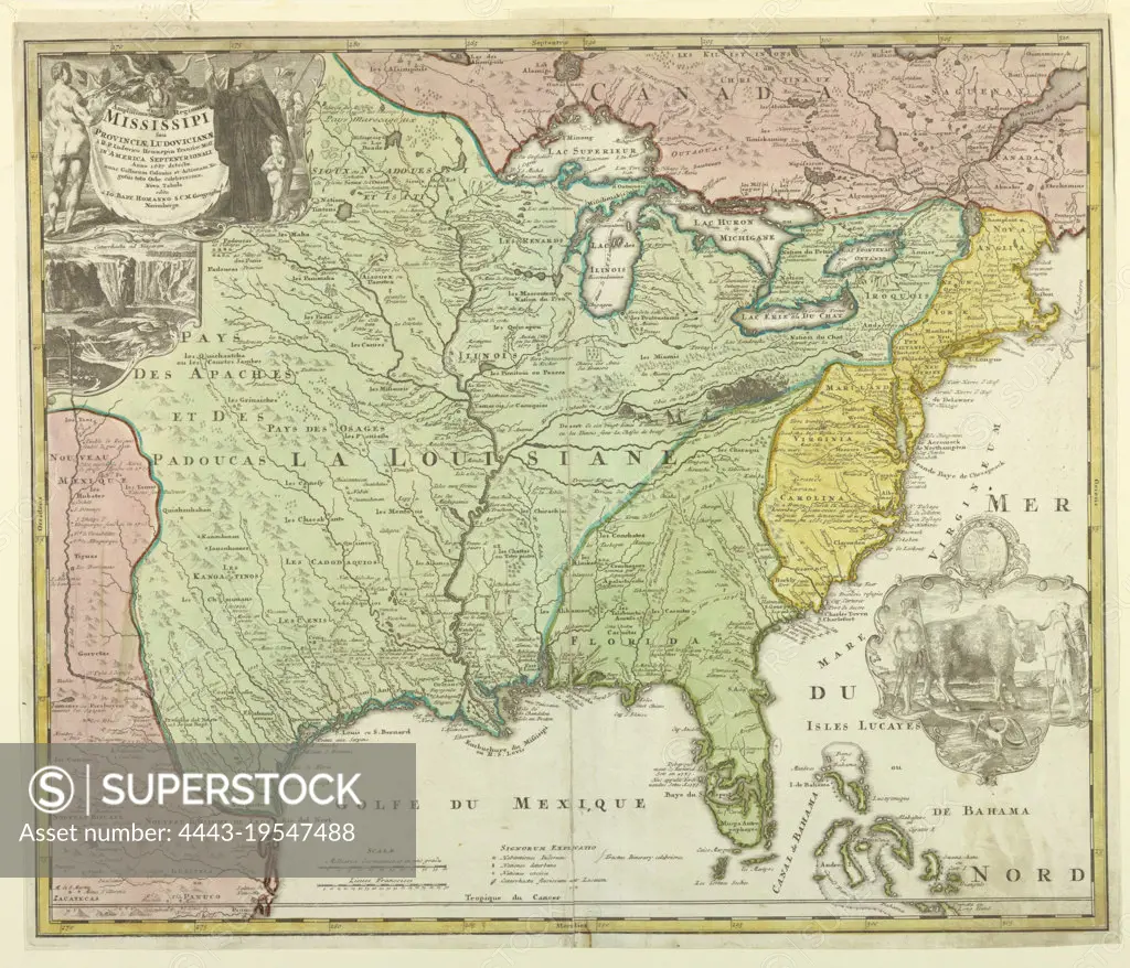
SuperStock offers millions of photos, videos, and stock assets to creatives around the world. This image of Map of Louisiana (Mississippi), Johann Baptista Homann, 1664 - 1724, Etching and engraving, hand-colored, on white laid paper, Map of Louisiana shows the Eastern part of the United States up to Canada; different colors are used for Louisiana (green), Eastern States (yellow), New Mexico (pink) and Canada (pink). On upper left corner, title of map embellished with an allegorical figure; below view of Niagara Falls. In lower right corner, a vignette with the coat-of-arms of Lns. Gall Societatis Indiae Occidentalis and below and Indian man and woman with a bull. (OPB '59), Germany, after 1718, ephemera, Print, Print by Artokoloro is available for licensing today.
Looking for a license?
Click here, and we'll help you find it! Questions? Just ask!
Click here, and we'll help you find it! Questions? Just ask!
DETAILS
Image Number: 4443-19547488Rights ManagedCredit Line:Artokoloro/SuperStockCollection:Artokoloro Model Release:NoProperty Release:NoResolution:6135×5264